Copyright ©2022 Deborah M. Zajac. ALL RIGHTS RESERVED. DO NOT USE MY IMAGES WITHOUT EXPRESSED WRITTEN PERMISSION!

Fuji X-T3| Fujinon 16-80mm| PS CC 23.5.0
more to come…
“A good snapshot keeps a moment from running away.” ― Eudora Welty
Copyright ©2022 Deborah M. Zajac. ALL RIGHTS RESERVED. DO NOT USE MY IMAGES WITHOUT EXPRESSED WRITTEN PERMISSION!
Fuji X-T3| Fujinon 16-80mm| PS CC 23.5.0
more to come…
Copyright ©2021 Deborah M. Zajac. ALL RIGHTS RESERVED
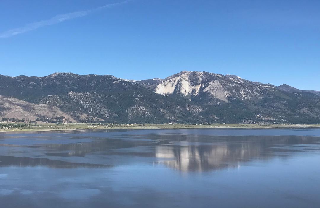
At the end of May He-Man and I went for a hike on a new to us trail called Deadman’s Creek Trail. It’s a nice short trail just a wee bit over a mile up and 280 foot elevation gain with a wonderful payoff at the end. There’s a lovely gazebo at the top of the hill, and the view is gorgeous.
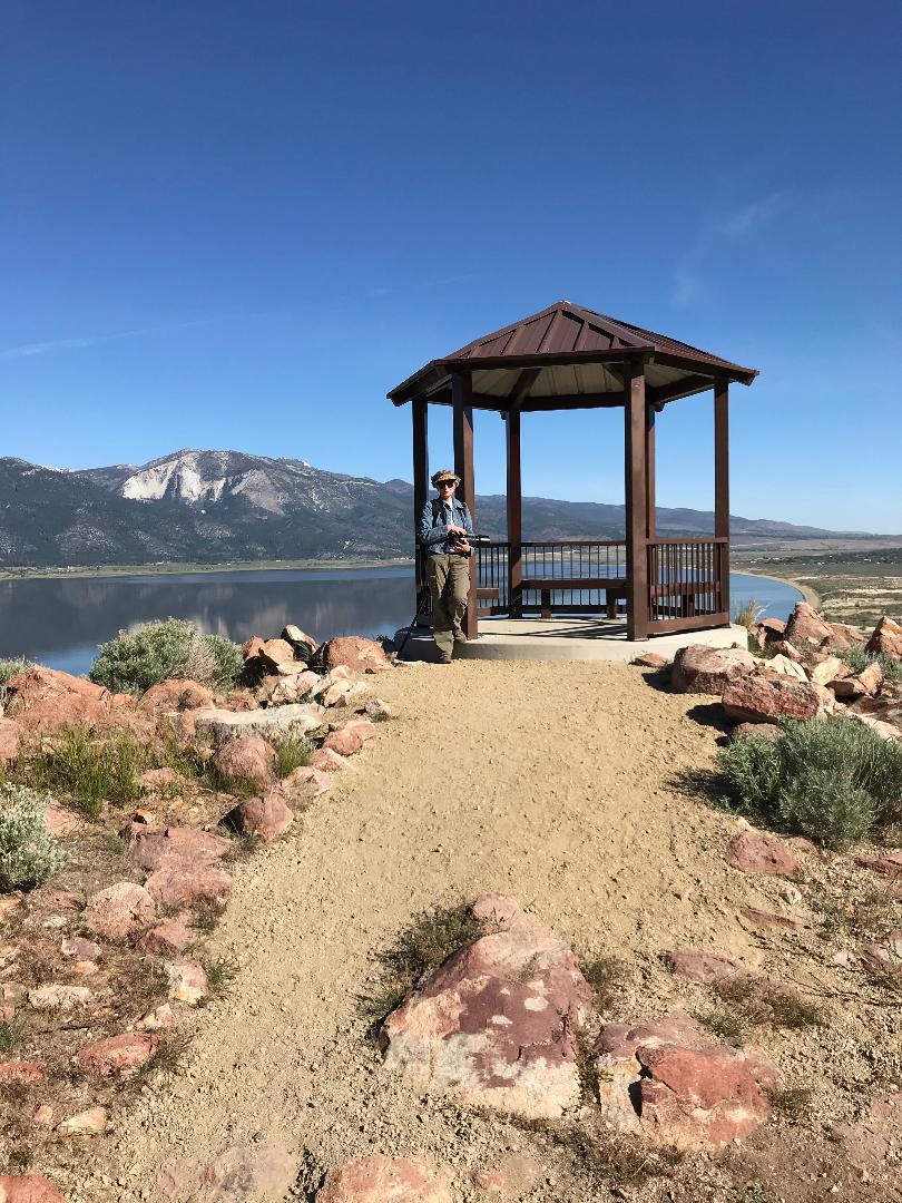
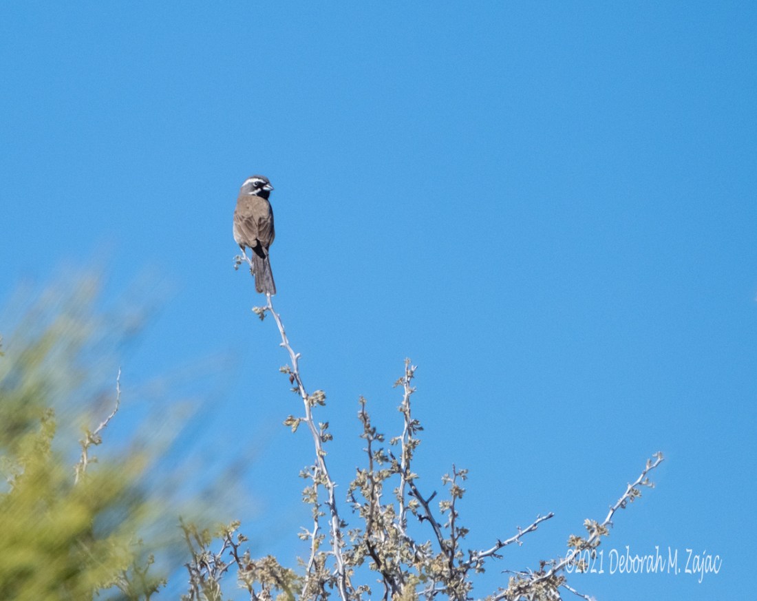
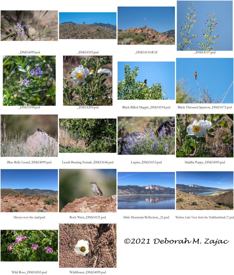
To top this off being a nice hike it was an even better hike because I saw three new to me birds on this trail!!
Number 3 new bird for the year was the Rock Wren. It posed for me nicely. Later it sang for us too.

On the way down I saw the next two. First was the Female Lazuli Bunting. It’s not a great image as she was out of range of my lens, but it was a good enough look to get her identified. I’ve seen the male before but, not the female so I was excited to have now seen both the male and female of the species.

The last new to me bird was the Black-throated Sparrow. I’ve been back to try to get a better image of it twice, but I haven’t seen it again.
All I know of how the trail got its name is back in the 1860’s a man bought a ranch near here and grew produce to sell to the miners in the valley. In 1864 he sold half his ranch to another man who became his business partner, but in 1865 the two ranchers were found shot dead. It was first thought they were murdered, but later they changed the thinking to a murder suicide situation. It’s a story true to the Wild West tales that’s for sure.
On a happier note there were wildflowers in bloom along the trail too. I put together a Contact Sheet with several thumbnail images of the highlights of the hike to share.
We’ve had #1 Grandson with us for 11 days and Big Baby Boy flew up for a short visit too. We’ve been going to the lake to beat the heat and paddle on my SUP board. If you follow me on Instagram you may have seen some of my images and videos of that so I won’t repeat that here.
Big Baby Boy left Tuesday, and Baby Girl, The Handsome Surveyor, and Littlest are arriving this evening for a short overnight stay and take #1 Grandson home tomorrow. The visits went by too fast!! That catches you up on my doings. What’s new with you?
I hope you’re all having a lovely week, and you have a great week-end!
Fuji X-T3| Fuji 100-400mm| iPhone 7Plus| Photoshop CC 22.4.2
more to come…
Copyright ©Deborah M. Zajac. ALL RIGHTS RESERVED
Reading at the Lake-
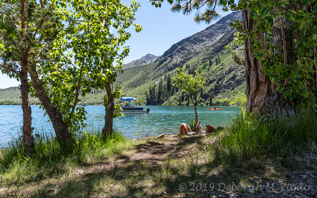
Convict Lake, Eastern Sierras.
UPDATE: I’ve often wondered how Convict Lake got its name, and some have asked me in the questions so I finally looked it up. Here’s how it got its name:
“In September of 1871, a group of convicts escaped from Carson City, Nevada, and were cornered by a local posse by the lake. A shootout took place and two members of the posse were killed, including Benton merchant Robert Morrison. The biggest peak above the lake, Mount Morrison, was named in his honor and the lake was renamed after the incident.
The convicts were eventually caught and two were brought to frontier justice. Several movies have been made about how Convict Lake got its name, and even more movies, commercials and ads have been shot at the picturesque lake. Beauty is just part of its appeal. Convict Lake, however, calls to people with more than just its looks. The unique character of the place has a pull, too.” ~ https://www.visitmammoth.com/blogs/how-convict-lake-got-its-name
It’s a great place to fish, hike, and have ice cream at the store.
Nikon D810| Nikkor 24-120mm| Lexar Digital Film| PS CC 2019
more to come…
Copyright ©2019 Deborah M. Zajac. ALL RIGHTS RESERVED
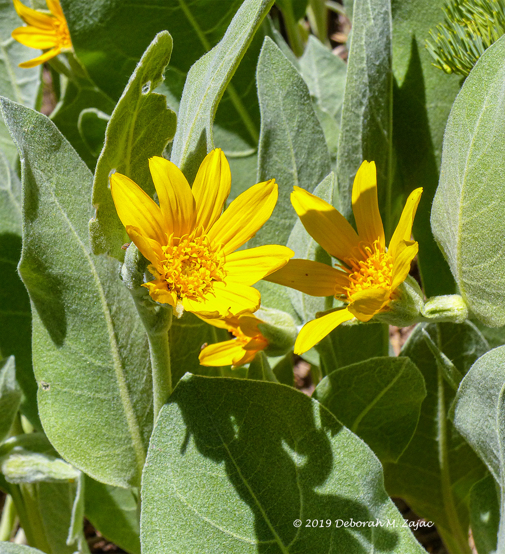
Saturday He-Man and I went hiking along the Tahoe Rim Trail. We heard the views were amazing, and I want to get back in shape and explore our new area. Since I feel out of shape and easily winded at this altitude still we opted for a 3 mile out hike and back.
We quickly discovered that Spring has sprung in the mountains at 7000 and 8000ft elevation. I was so excited!
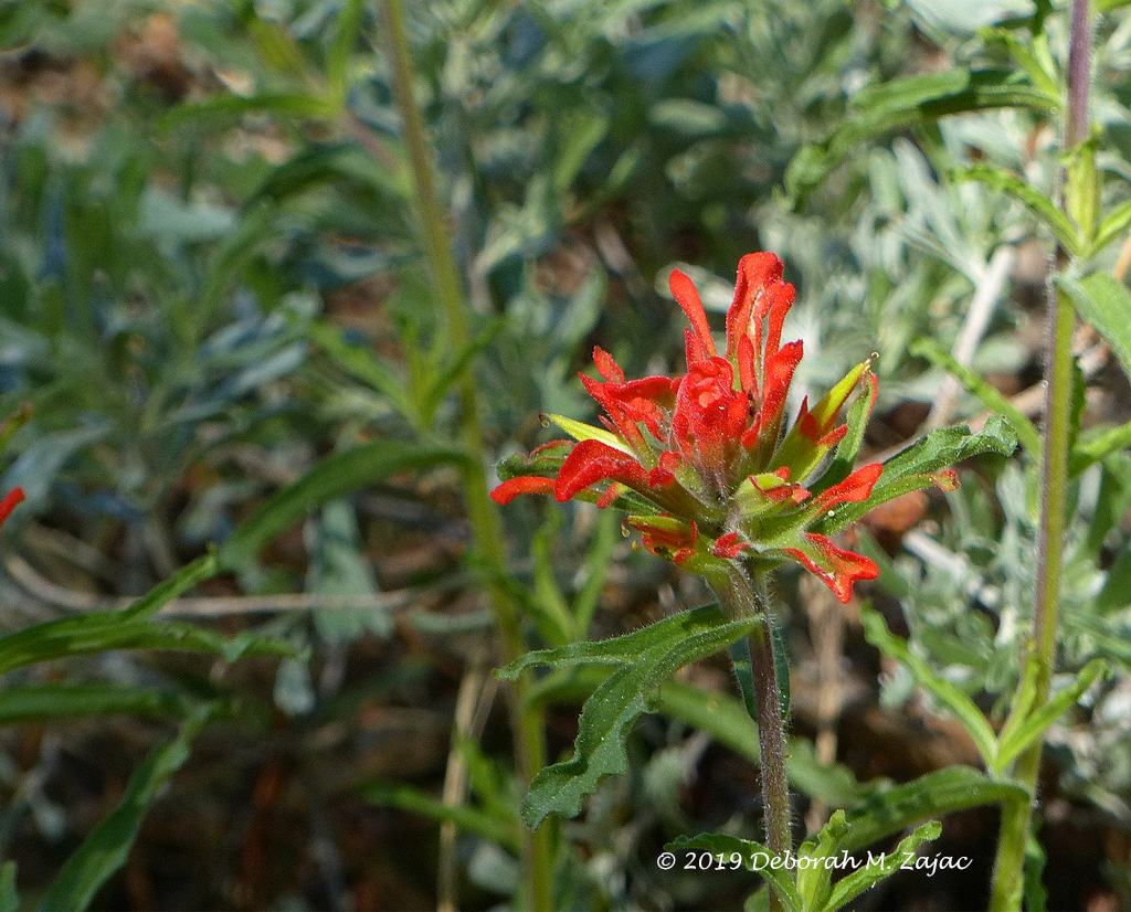
Here are just a few of the flowers we saw.
Nuttall’s Larkspur with Bumble Bee. We took a side trip up the Vista Trail to the top of a ridge and found a view of Carson Valley and these wildflowers busy with Bumble Bees.

Mule’s Ear was blooming all over the place and it was perfect blooming time!
Coast Paint Brush? I’m not positive this is what it is, but it looks like it.
There were thousands of Butterflies along the trail. I thought at first they were Painted Lady’s which I had heard were migrating through and there were thousands being reported but looking at them and my images confirmed that’s not what they were. It’s new to me called a California Tortoiseshell ( Nymphalis Californica). There was also White cabbage and Sara Orange Tips I believe but, those little guys were already warmed up and flying all over the place rarely landing and when they did they alighted almost as soon as they touched down.

We had a glimpse of Lake Tahoe about 2 miles into the hike. It was a great place to catch my breath too.

I have more images of flowers I need to identify, and two birds too.
There is a gorgeous view we’re told 5 miles in, so we’re going to work up to that. The Tahoe Rim Trail is 165 miles long going around Lake Tahoe. I’m hoping to do bits and bobs of it here and there, but I don’t think I’ll ever do the whole thing.
Our stats for the hike were:
6.5 miles total distance, 1000 ft elevation gain, and 3H:56 minutes…due to me stopping to smell the roses, watch butterflies, gaze at the views, and stopping to catch my breath.
It was a great hike! I hope I can get back up there before the butterflies flee, and the Lupine is in bloom.
I hope you’re all having a great week, and good Wednesday!
Panasonic Lumix FZ200| Lexar Digital Film| PS CC 2019
more to come…
Copyright © 2017 Deborah M. Zajac ALL RIGHTS RESERVED
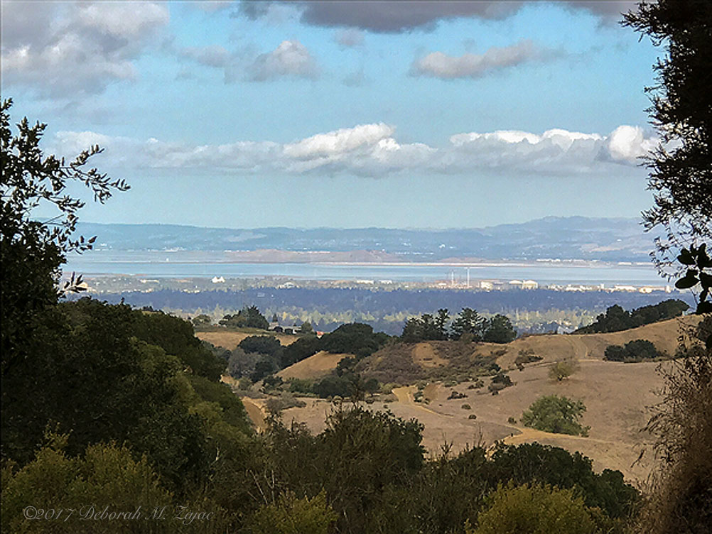
I thought I’d share with you some recent images from the trail. The clouds were gorgeous, and the deer were too, and I loved the Oaks that lined the trail a little bit more than usual on this morning hike.
I was on the way down here. The view is looking at the southern end of the San Francisco Bay Area. The white teeth like structure left of center near the water is Shoreline Amphitheater, and moving to the right are the hanger of Moffet Field looking small from up here. The mountains in the distance is the Diablo Range.
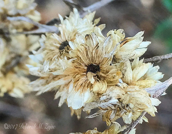
Autumn was on display. Even dying I thought the blossoms were pretty.

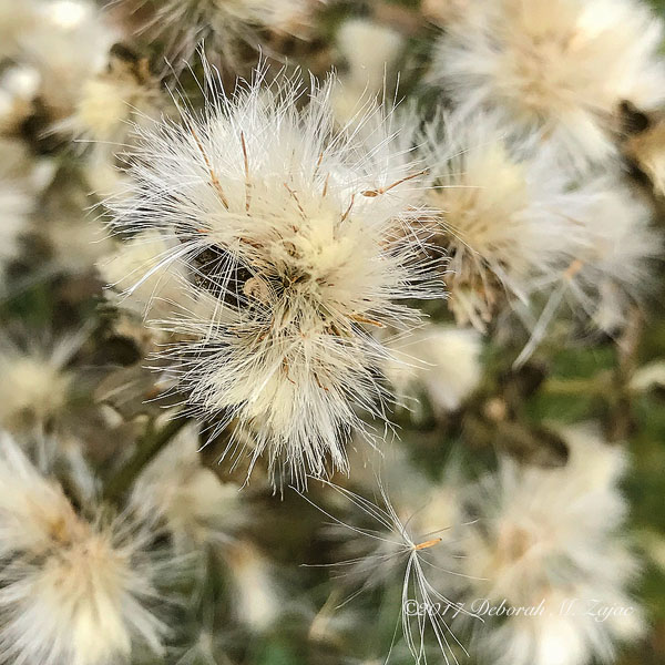
I think this is a Coyote Bush. It goes all Fuzzy this time of year.
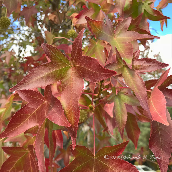
The trail…

The Toyon are full of red berries this time of year…

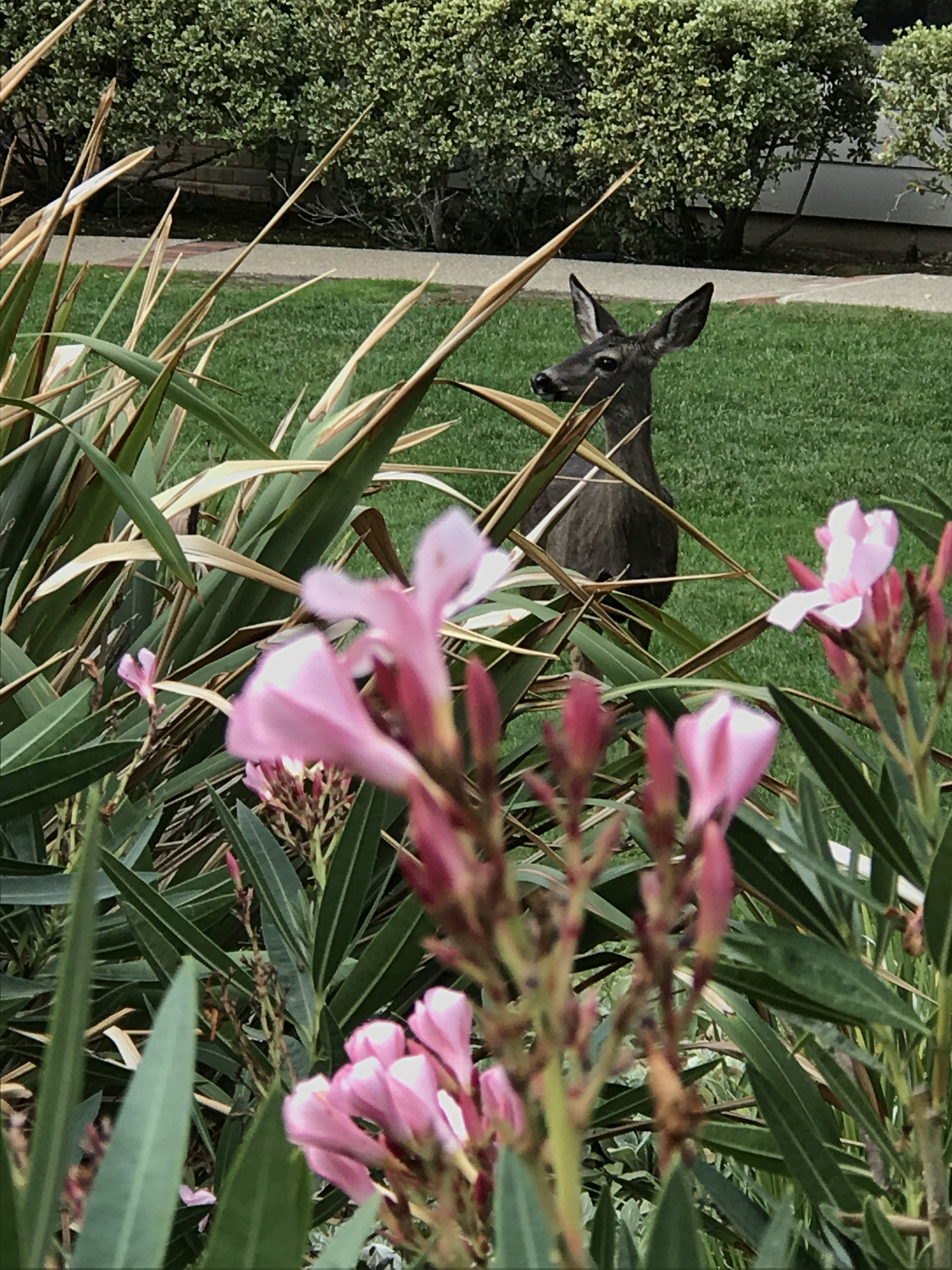
and the wildlife… I saw a young Buck, a Doe, and some wild turkeys along with the usual suspects; squirrels, and birds. This pretty doe was in the front yard of home when I was headed up hill along the road to the trail-head.
I made two short videos. One of the Buck, and the other of the wild Turkey’s.
Here’s the video to the Buck. I dislike my voice in this video, but can’t figure out how to mute it so no one has the option to hear it. 🙂 I couldn’t upload the video directly from my computer, so had to put it up on YouTube.com for you to see.
I hope you all have a lovely week-end and your views where ever they are are wonderful.
iPhone 7 Plus| PS CC 2018
more to come…
Copyright ©2017 Deborah M. Zajac. ALL RIGHTS RESERVED
I didn’t get out too much this past week-end unfortunately, my original plan to shoot the night sky Saturday fell apart. So I had a Plan B, but that fell apart too. (sigh) Plan A got cancelled due to all the smoke in the air from the Detwiler Fire burning near and around Mariposa, and Yosemite NP. As I write this 76,000 acres have burned. Evacuation orders have been lifted in some areas, but Firefighters are saying it may take up to two more weeks for the fire to be fully extinguished. It’s so sad!
Plan B was scuttled when a friend had to change plans, and I didn’t want to be alone so I stayed home and painted a bit.
Before all that happened my Archive Drive crashed Thursday and Saturday afternoon we were still recovering images and documents from our back-up drive, and cloud service. I can’t tell you how scary that is to think thousands of images made over the course of many years may be lost! I’ve got them all back, but my external drive is full no doubt due to the huge 36mp files of the D810 so, we bought a new external drive which should be here this week. Then I’ll have my stuff backed up two places, have room to grow, and feel much, much better!
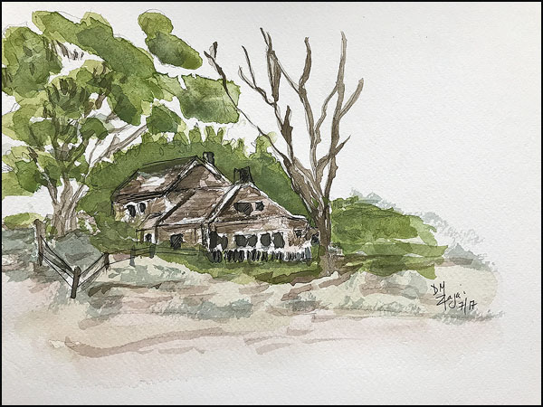
Saturday evening I pulled out an old book I have by Ferdinand Petrie, called Drawing Landscapes in Pencil and stayed up late to practice some drawing then I added some watercolor to it. Wanna see? If you follow me on Instagram you’ve already seen this. 🙂
I had some new watercolor paper to try too. It’s by Legion papers called Stonehenge Aqua. I like it. There’s not much blooming or bleeding, and the colors look wonderful on it to me. It’s got some tooth, but not as much as Arches cold press paper. I prefer the smoother hot press papers, so this paper just might be the perfect balance for me.
Sunday He-Man and I rose early to get on the trail early; we were extending our route and wanted to beat the heat. It was going to be in 90’s again Sunday. We were on the trail just before 7am. There were quite a few cars already parked near the trail-head when we arrived. A lot of others had the same idea to beat the heat and get an early start. We parked at the bottom of the mountain, and planned to hike up into Fremont Older an Open Space Preserve.
There are a few options to get up there; the most popular routes are: take the road all the way up to stage 3 of the Parker Ranch Trail system and hike the rest the way up via the trail, or do what we did and walk along the road to Stage 1 of the trail, then you come out on the road again for a bit then catch Stage 2 which is the toughest bit with some switchbacks at an 8% grade. I was huffin’ and puffin’ going up those. At the top of those you meet Stage 3 of the trail. There are two sets of switchbacks on this part of the trail, but they aren’t nearly as steep as Stage 2’s.
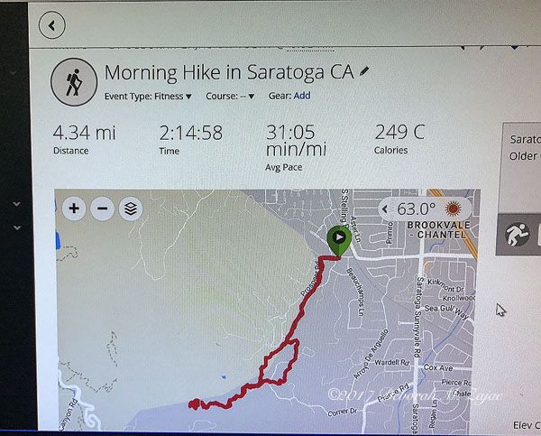
When we crossed into Fremont Older Open Space Preserve we hiked up to the top of the Toyon Trail then turned around to head back. We altered our route on the way back by bypassing the Stage 2 part and chose a different section of the trail that meanders through an Oak grove, and you climb another steep hill to meet the road. We walked down the road to Stage 1 of the trail and caught the road back to the car. Phew! Hope that makes sense! Here’s a screen shot of my route from my Garmin Edge 500.
He-Man’s not as fast as he was going downhill since his Patella Tendon ruptured nearly 3 yrs ago so, if my time looks slow…it is. When I’m heading down at my normal pace I get way ahead of him so, I turn around a go back until I see him. I get some extra steps that way too. 🙂
There was a lot of fog and, we’re getting some smoke from the fire up here. Here’s one image from the trail. I took this with my iPhone. I went gear light today.

The faint peak in the fog and smoke on the right might be Mt. Diablo at (3,889 feet (1,185 m)) high. The highest hilltop on the left is Hunter’s Point in Fremont Older Open Space Preserve.
We hiked 4.34 miles, gained 827 ft in elevation, and were back in the car headed home by 8:55am! Not too bad.
We spent the afternoon looking at Loveseats, and bought two. Our current two are really beat up and have needed replacing for over a year, but with a 4 yr old at home we put it off for as long as we could stand it. Now we’re excited for the new ones to arrive!
That was my week-end. I hope you all had a lovely week-end and got to have a bit of fun, and relax so you’re ready for the week ahead. I hope it’s a great week for us all!
iPhone 7 Plus| PS CC 2017
more to come…
Copyright ©2015 Deborah M. Zajac. ALL RIGHTS RESERVED.
So, WP has changed the layout and look of posting, and adding images is different. I’m kind of struggling through the new changes. Was there a memo about the changes? I missed it if so.
For this week’s MM2; and I’m really late posting mine this week! Is another image from my hike up Slacker’s Ridge Trail. This image I made during the Golden hour before the mad rush of people headed out of the headlands, and into the city for dinner, shows, and general Saturday night Merry Making. 🙂

Okay. Inserting my image went well this time. I didn’t have to delete it and try again! YEAH! “)
To see all the images posted this past week click here.
Nikon Df| Nikkor 24-70mm| Hoodman STEEL Ultra High Speed Digital Film| CS6 & Silver Efex Pro
More to come…

You must be logged in to post a comment.