Copyright ©2023 Deborah M. Zajac. ALL RIGHTS RESERVED.
PLEASE DO NOT USE MY IMAGES WITHOUT EXPRESSED WRITTEN PERMISSION.

Nikon D810| Nikkor 24-120mm & iPhone 14 Pro
more to come…
“A good snapshot keeps a moment from running away.” ― Eudora Welty
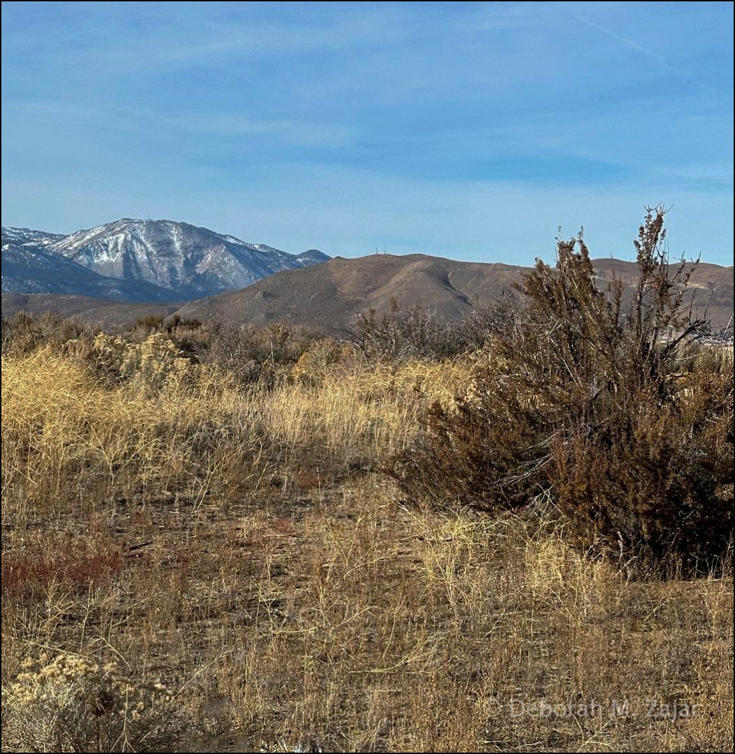
Trails, locations of hikes
Copyright ©2023 Deborah M. Zajac. ALL RIGHTS RESERVED.
PLEASE DO NOT USE MY IMAGES WITHOUT EXPRESSED WRITTEN PERMISSION.
Nikon D810| Nikkor 24-120mm & iPhone 14 Pro
more to come…
Copyright ©2017 Deborah M. Zajac. ALL RIGHTS RESERVED

Nikon D700| Nikkor 24-70mm| Hoodman Digital Film\PS CC 2017
More to come…
Copyright ©2105 Deborah M. Zajac. ALL RIGHTS RESERVED
I didn’t venture too far for this image; just down the street. In hindsight I should have sought higher ground. Venus was setting fast and if I had been higher I might have been able to photograph longer ,so that Jupiter would have been brighter. Live and learn!

I do like the way the Moon looks, and am pleased I didn’t blow it out. 🙂
Jupiter is that teeny tiny white dot above and to the right of Venus which is the bright star next to the New Moon.
Nikon Df| AF-D 105mm f2.8@ f/10| 0.3sec| ISO 400| Manual Priority| Manual Focus| Tripod| Hoodman STEEL Ultra High Speed Digital Film| CS6
+ 1 More…
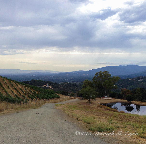
He-Man and I have been hiking every week-end together since his Dr. and Therapist gave him the okay after he ruptured his Patella Tendon and had surgery last November. He’s really come a long way.
Today he was up for hiking the steepest, and longest hike since he was given the okay.
We gained about 1000 ft in elevation and hiked just about 5 miles. Here are several images I made along the hike.
All were taken with my iPhone 5 and developed in Photoshop CS6
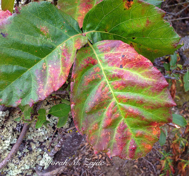
Hiker’s Foe…Poison Oak
Rain Clouds in the Southeast….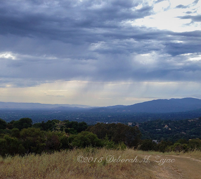
<Moffett Field Historic Hangers

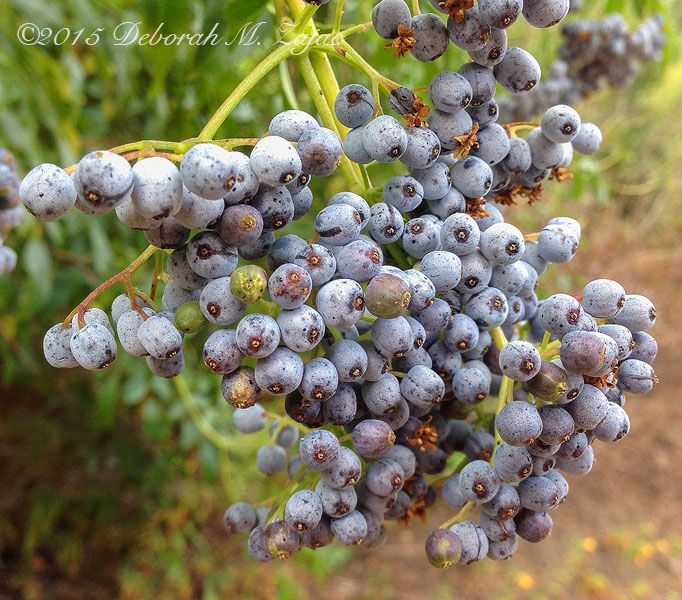
An unidentified wildflower…or not

Garrod Pond…when we take #1 Grandson on Pony Rides it’s at this stable, and pond that the guides walk him. I love seeing how excited he is walking the Ponies around this pond looking at birds/ in the trees for birds, and looking for ducks in the pond. His Mother says I am influencing his interests. I can’t say I’m totally innocent or sans motive! If I am able to influence him to love nature, an his environment then I think I can take a back seat and let the young lead.
I OT: I offer no excuses I love being a Grandma, and I’m really glad that I’m able to keep hiking, moving my legs, and hope that I am able to for many years to come! I hear the secret to living a long happy, active life is keeping the legs moving.
I am going to try my best to keep moving…uphill! The reward is going home down hill all the way baby! 🙂
More to come…
Copyright © 2014 Deborah M. Zajac. ALL RIGHTS RESERVED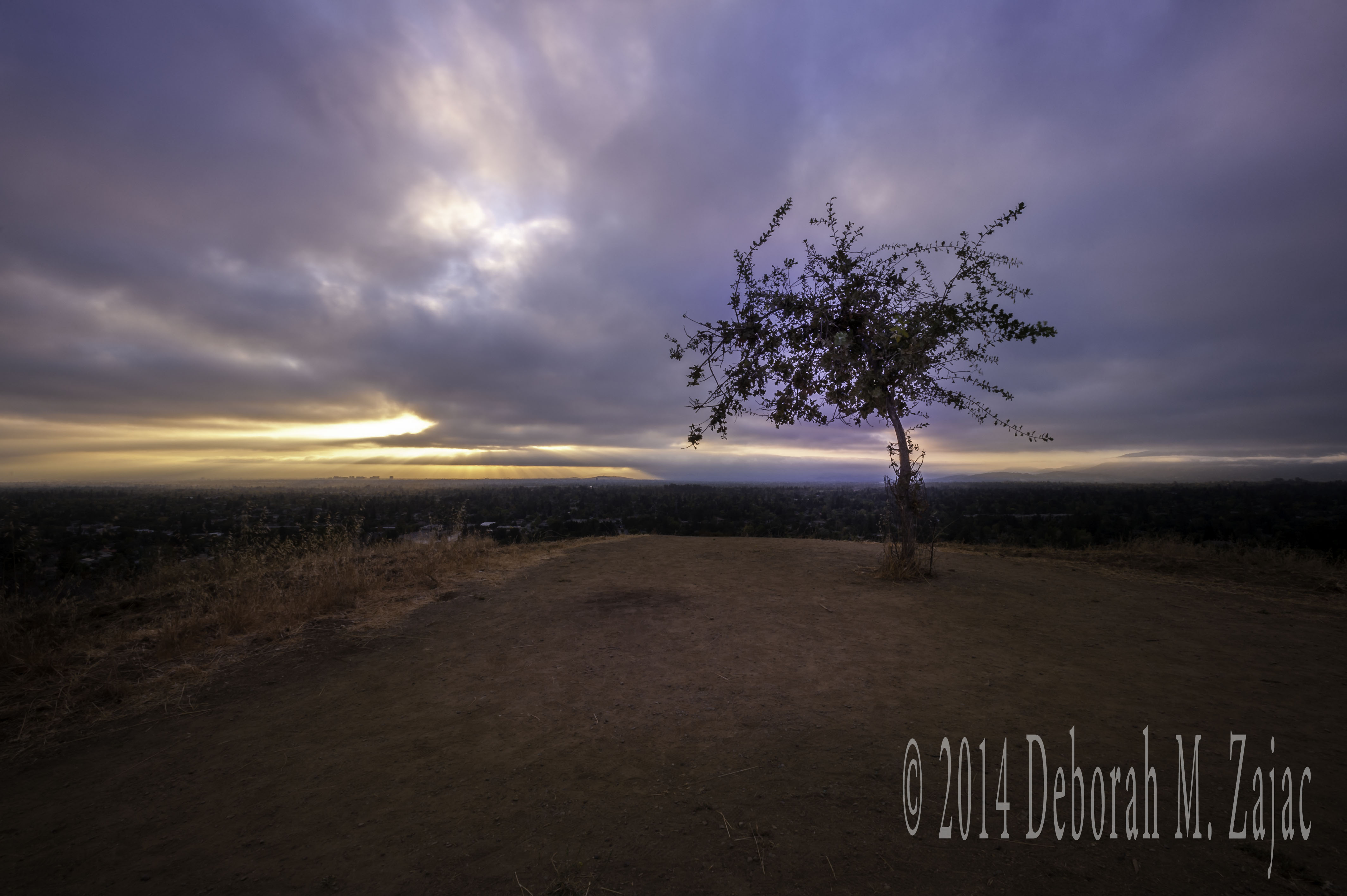
Mornings are arriving a little later, and chillier these days and with that I’m finding it a little harder to get out of the house for a hike or walk. Once I get out I am usually very happy that I did.
This morning was especially nice as we had a lot of clouds which meant there might be some color, and I got lucky and had “God Rays” too, and there was a bonus; the sign marking the trail’s boundary is gone!
YEAH! I have spent years framing around it, cloning it out, or cropping it out. It was lovely shooting and not have to deal with it, or deal with it later in post development. I’m keeping my fingers crossed that they don’t replace it, and if they do they put it somewhere that doesn’t hinder the view.
Nikon D700| AF-S Nikkor 17-35@ 17mm| f20| 5 seconds| ISO 200| Tripod| B+W 6 stop ND filter
Copyright © 2014 Deborah M. Zajac. ALL RIGHTS RESERVED
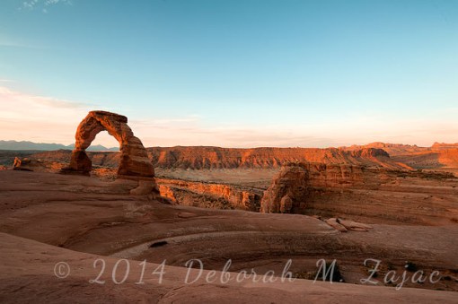 Alex, Theresa, and I started our hike to Delicate Arch at 4:10am and got to the Arch in 42 minutes with only head-lamps for light. There was only one other car in the parking lot when we arrived. We met the two guys that it belonged to on their way down.
The trail-head to Delicate Arch is right off the parking lot at Wolfe Ranch inside of Arches National Park. The elevation gain is about 500 ft up rough and steep terrain. Length of the hike is 3 miles round trip. Most the trail you’re hiking on giant slabs of sandstone. The trail is marked by cairns, but some are widely spaced so, if not carefully looking for them you can miss one.Theresa and I missed one on our first hike up to Delicate Arch back in 2010 we ended up about quarter of mile off course and had to back-track to find the trail.
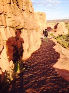
The last bit of the climb is along the side of sandstone fin. There are several steps and a path that was carved out of the stone that wind their way up to the Arch. This part of the path is fairly narrow and has no cable or guard rail- If you fall you could be toast.
Here’s an image Theresa took of us hiking down that part of the trail. That’s Alex, with me in the lead, and Theresa’s shadow on the sandstone wall. Thank you T for giving me a copy of this image! xx
There was no one else up at the Arch when we got there, but it wasn’t too long before other hikers were coming up the trail, and by 6AM there was quite a crowd, and it was getting warm already. We stayed up through Golden Hour and when the light went flat we packed up and hiked down, starving and ready for breakfast then a nap.
More to come…
NIkon D700| AF-S Nikkor 14-24mm f/2.8| Tripod
Copyright © 2014 Deborah M. Zajac. ALL RIGHTS RESERVED
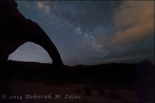 I had a fun week-end in Moab, Utah with friends Alex and Theresa chasing the stars. Our goal was to shoot the Milky Way at Corona Arch, but the first night was really cloudy so we went to Dead horse Point in Canyonlands State Park for sunset. We didn’t have much color, but the clouds were dramatic.
 Saturday morning my alarm went off at 3 A.M. I snoozed for a few minutes then got up, dressed then the 3 of us left the hotel and were at the Trail head to Delicate Arch at 4:10 A.M. It’s a 1.5 mile hike up to Delicate Arch with a 500 ft elevation gain. It took us 42 minutes to ascend to Delicate Arch in the dark. (we had head-lamps)
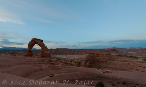
Not much color this morning facing this direction: South-southeast, but still pretty. While waiting for Golden Hour we met Adonis Farray who is from Canada. We all hiked down together then parted ways. Starving we headed to Moab for breakfast. We went to the Jailhouse Cafe and had just put in our order when in walked Adonis! We invited him to our table. Over the course of our conversation we discovered he hadn’t ever shot the Milky Way so of course we invited him to join us if he had the time. He altered his plans and stayed another day in Moab in order to join us. He will tell you I held a gun to his head. 🙂 It didn’t take too much arm twisting to convince him it was worth a second hike up to Corona Arch.
After breakfast we all headed back to our hotel rooms to take a nap, and prepare for our upcoming night shoot. I woke up before my alarm and so did Theresa so we went for a quick swim at the pool then went back to shower, and meet Alex for dinner before heading up to the Corona Arch trail-head where we would meet Adonis.
We started the hike up to Corona Arch about 7 P.M. The outside/ambient temperature was 101 degrees. You start climbing straight-away up a dirt and rocky path which soon levels out for a short distance then it meanders up through a canyon; you cross one set of railroad tracks then continue up the path. Soon the path gives way to sandstone and red rock. You hike across a steep rock with a well-worn path in places and no trail at all in other places, but it is marked along the way with cairns, there’s a part of the rock that slopes so you’re walking on an angle but there’s cable to hold on to which helps. Then you begin to climb up the canyon wall following the cairns.
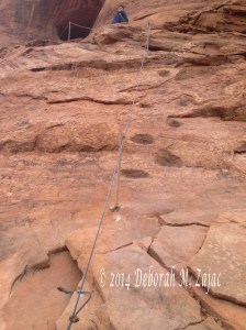
Not too long after you leave the cable behind you come to another cable that helps you climb a much steeper, but short rock. There are shallow foot holes cut into the rock face that make the 15 foot climb much easier. I took this image of the cable back in Feb. with my iPhone. That boy about 10 yrs old ran up the rock opposite the cables- too impatient to wait for us to go up then he waited for his parents at the top.
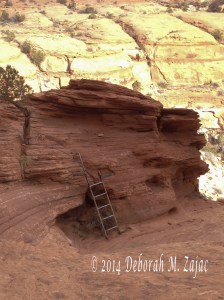
 With that challenge behind us we continued on a short distance only to meet with another steep rock to climb, but a ladder is there to help you up, or you can hike up and around it which is what I did this trip. This image of the Ladder I took back in Feb. with my iPhone
 By now you are hundreds of feet high above the canyon floor hiking across the canyon wall on a huge slip rock ridge with a gentle uphill slope that leads you right to the Arch.
The 1.5 mile hike up to the Arch is packed with fun and challenging terrain. Here’s how the Arch looked when we got up to it. Taken with my iPhone 5
 Alex had checked our calculations for the night shoot before we left the hotel using Stelliarum so we had a pretty good idea of where the Milky Way was going to rise. We set up and waited for it to get dark enough to see it.
The temperature started cooling off about 9 P.M. and by 9:30 P.M. it was dark enough to see more and more stars shining bright against the darkening sky.
Theresa brought along a strong flashlight for light-painting. While we were making images of the Arch in the Blue Hour with Theresa light-painting it she stopped and said, “I hear rustling in someone’s back pack. Like animal critter kind of rustling noises.” We all stopped what we were doing to investigate. Turning the light beam over to the pack Theresa saw a mouse in Adonis’ pack! Adonis had left it open and the mouse was trying to get his trail mix. The light beam, and Adonis poking his pack scared the mouse who came running out of the pack and straight into one of the holes in the rock behind us, but he came out of that hole just as fast with angry wasps on his tail! We discovered earlier that all the holes in the rock behind us were filled with wasp nests. We were set up in front of them, but far enough away not to disturb the wasps. The mouse got away up and over the rock and thankfully we didn’t see it or the wasps again.
We hoped we would have breaks in the clouds giving us some kind of view of the Milky Way and we got lucky! Adonis said he’d put in the order with the weather Gods. 🙂 We shot for a couple of hours then we packed up, and with head-lamps lighting the way we started to make our way down from Corona Arch. With our lamps on the white light we were assaulted by little gnat like bugs. Yuk!
Our Theresa got a touch of sun exhaustion and didn’t feel good at the start of the decent. Thankfully she was able to hike down without difficulty- she was tired, hot, nauseous, had a head-ache, and thirsty despite drinking 64 ounces water that day. By the time our plane landed late Sunday afternoon she was looking and feeling much better.
Our day for the Milky Way shoot started Saturday July 26th at 3 A.M. and ended when I went to bed on Sunday July 27th at 1 A.M. We got a lot of hiking in. 8.2miles total, and I had a lot of fun with dear friends, and new friend from Canada Adonis.
More to come…
Unless noted- All images taken with a Nikon D700 w/Nikkor 14-24mm f2.8 lens
Copyright © 2014 Deborah M. Zajac. All Rights Reserved.
 We hiked to Mission Peak this morning. It’s a tradition of sorts to hike up here when Big Baby Boy is home. We had a 3 day week-end in the States, so my son and girl-friend came up from Southern CA to hang out with us and #1 Grandson. His girl-friend had never hiked up here before. She’s amazing she ran the last steepest 500ft to get to the top. She was excited to get there.
It was exciting for me too. I have a new Personal Best time for the hike up 1h 31m!
Instead of taking my photo on the pole…which I’ve done before a few times I took a photo of my toy mascot Travelerette on the Survey Mark. Someone stole the little plate, but the nails spelling out Mission Peak, and elevation are still there. Mission Peak is in the Diablo Range in Northern California. It is 2,517 ft high, and nearly every step of the 3.4miles we hiked is steep, steep, steep! We hiked the Less Steep Route which is 3.4 miles to the top with an elevation gain of 2,017ft. Total miles hiked 6.8
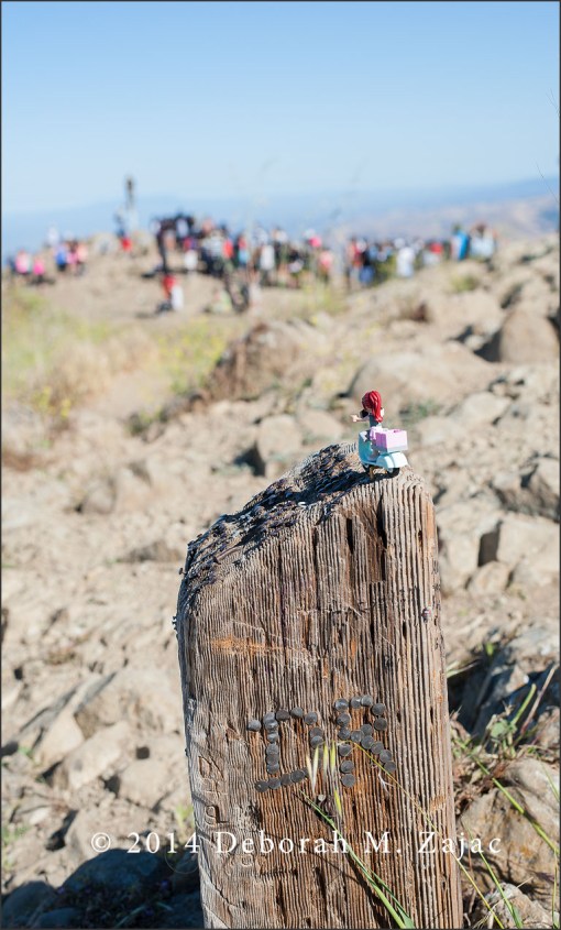 It was very crowded up there today. The line to stand on the pole and take your picture was long. It took us a half hour or more. I was pleased to see it has become custom to wait in line for your turn since my last hike up to the pole. Honestly it’s got to be so popular up there avoid week-ends, and holidays if you can!
Look at this line! There were 4 to 5 people ahead of me not in the frame.

Nikon D700| AF-S Nikkor 50mm f1.8G @ f8| 1/250s| ISO 200| Manual Priority| Matrix Met| Hand-held

You must be logged in to post a comment.